


 Play store

A magnitude 6.9 earthquake struck Indonesia’s western Sumatra island late Saturday, the second strong tremor to hit the country within a day, according to the US Geological Survey (USGS).
The latest earthquake struck at 10:54:52 UTC, with its epicentre about 7 kilometres northwest of Pematangsiantar in North Sumatra, according to the USGS. The quake occurred at a depth of about 183 kilometres, making it a relatively deep earthquake.
The epicentre was around 126 kilometres (78 miles) southeast of Medan, the capital of North Sumatra, according to reports citing USGS data. There were no immediate reports of casualties or significant damage following the tremor.
No tsunami warning was issued following the Sumatra earthquake.
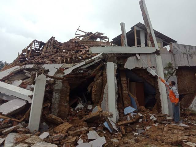
The tremor came just hours after a much stronger magnitude 7.7 earthquake struck off the coast of eastern Indonesia, near the Flores region, early Saturday. That earthquake caused significant damage and casualties, particularly on Flores Island, and briefly triggered a tsunami warning.
The earlier earthquake was considerably shallower than the Sumatra tremor, increasing its potential to cause severe surface shaking and damage. Indonesian authorities reported deaths, injuries, collapsed buildings and landslides in areas affected by the earlier quake, while rescue teams faced difficulties reaching some communities because roads and communications were disrupted.
The occurrence of two major earthquakes in different parts of Indonesia on the same day has heightened attention to the country’s vulnerability to seismic hazards. Indonesia lies along the Pacific Ring of Fire, one of the world’s most active tectonic zones, where several major tectonic plates meet and earthquakes and volcanic eruptions are frequent.
The USGS event data place the latest quake at 3.018 degrees north latitude and 99.038 degrees east longitude.
North Sumatra is no stranger to powerful earthquakes. The region forms part of the broader Sunda tectonic system, where the Indo-Australian Plate is being forced beneath the Eurasian Plate. This active tectonic setting has produced some of the world’s most destructive earthquakes, including the 2004 Indian Ocean earthquake, which triggered a devastating tsunami across the region.
Authorities and residents in affected areas were urged to remain alert for possible aftershocks and follow official information from Indonesia’s meteorological and geophysical authorities. BMKG officials have previously warned that aftershocks can continue following major earthquakes and advised the public not to be influenced by unverified information.
At this stage, the deep location of Saturday’s Sumatra earthquake and the absence of a tsunami warning suggest a substantially different risk profile from the shallow offshore earthquake that struck eastern Indonesia earlier in the day. However, assessments of possible damage and injuries may take time, particularly in remote areas.
The latest earthquake adds to an already challenging day for Indonesia’s disaster-response authorities, who are dealing with the aftermath of the earlier, more destructive quake while monitoring seismic activity elsewhere in the country.